10 Best Day Trips from Athens — by train, car, and boat
A working guide to getting out of the city, written by someone who has done every one of these runs more than once
L
Words by
Lena Hofmann
Updated
20 September 2026
Read time
13 minutes
Includes
10 places · interactive map
Athens has a way of consuming you. The Acropolis, the National Archaeological Museum, the noise and heat of Monastiraki on a Saturday afternoon — it is easy to spend a week inside the city limits and never once think about leaving. That would be a mistake. The Greek capital sits at the geographic centre of a country that is, in essence, a collection of day trips waiting to happen. Mountains within an hour's drive, islands reachable by hydrofoil before lunch, ancient bridges that have been standing since the Bronze Age. The infrastructure is imperfect — Greek trains run on their own philosophical schedule, island ferries are subject to wind, and parking near any archaeological site in summer is a quiet form of suffering — but the rewards are disproportionate to the effort.
A good day trip from Athens satisfies three conditions. First, the journey itself should not eat the day: two hours out, two hours back leaves you with a usable window in the middle. Second, there should be something specific to do on arrival, not just a vague sense of having arrived somewhere old. Third, the logistics should be solvable without a travel agent. Everything in this list meets those three tests. Some entries are famous; others are almost entirely unknown outside Greece. All of them have been tested by me personally, in multiple seasons, by different means of transport. I have missed the last ferry back from one of these islands. I have also sat alone at a Byzantine monastery on a Tuesday in November with no other visitors in sight. Both experiences taught me something. What follows is the distillation of all of it.
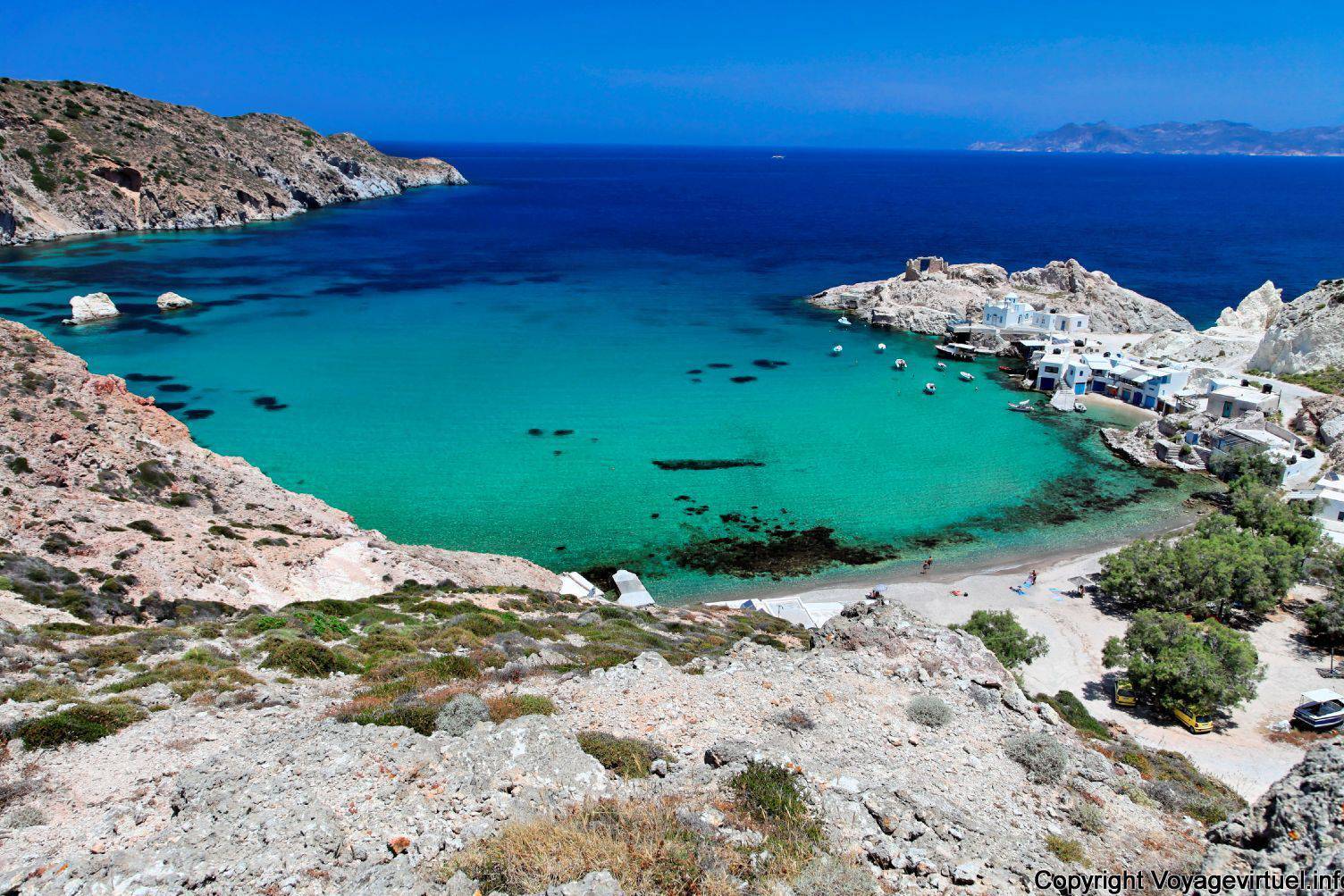
Milos , la sconosciuta: The island that earns its name
Milos sits in the southwestern Cyclades and takes its name from the same root as the Venus de Milo — the marble statue discovered here in 1820 and now permanently housed in the Louvre. The island itself, however, remains considerably less crowded than its famous export. Getting there from Athens means a ferry from Piraeus: fast ferries run the crossing in roughly three hours, conventional ferries in five to seven. That makes it a long day trip or, more honestly, an overnight — but if you take the first fast ferry out and the last one back, you have six to seven hours on the island, which is enough. On arrival, the priorities are clear: walk the harbour village of Adamas, take a short taxi ride to the ancient theatre cut into the hillside above the village of Tripiti, and find the sea caves at Kleftiko if a boat tour is running. The coastline here is volcanic, which means the rock colours are genuinely unlike anything else in the Aegean — rust, white, grey, and a particular shade of orange that appears in late afternoon light.
Insider tip
Book the fast ferry at least three days ahead in July and August — seats sell out, and the slow overnight option leaves you with almost no time on the island. The first sailing from Piraeus Gate E1 typically departs before 7am; bring coffee from the port.
2Historic town· 107.5 km
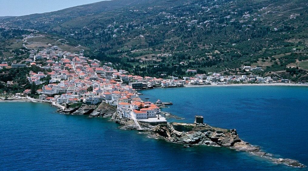
Chora, il cuore di Andros nelle Cicladi: The neoclassical Cycladic capital
Most visitors to the Cyclades fly into Santorini or Mykonos and never consider Andros, which is the archipelago's second-largest island and, in terms of architectural character, one of its most distinctive. Chora — the island's main town — is built on a narrow peninsula and lined with neoclassical mansions that reflect the wealth of the island's 19th-century shipping families. It looks nothing like the whitewashed cube villages of the southern Cyclades; it looks, instead, like a small Venetian-influenced port that has been thinking carefully about itself for several centuries. The ferry from Rafina (roughly 90 minutes by fast ferry, two hours by conventional) makes Andros the most accessible of the Cyclades from Athens. In Chora itself: walk the main pedestrian street from end to end, cross the small bridge to the ruined Venetian castle on the headland, and visit the Museum of Contemporary Art, which holds a serious collection in a building that punches well above its weight for a town this size.
Insider tip
Rafina port is 30km east of Athens and far less chaotic than Piraeus. A taxi from central Athens to Rafina takes about 40 minutes and costs around €35-40. Do not assume the Rafina bus from Pedion Areos square runs frequently — check the schedule the night before.
3Cultural museum· 102.2 km
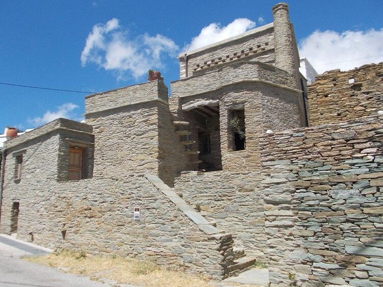
Cyclades Olive Museum in Andros: A working mill turned honest museum
If you are already making the crossing to Andros, the Cyclades Olive Museum in the village of Pitrofos deserves an hour of your time. This is not a reconstructed heritage attraction built for tourists — it is the preserved ground floor of an actual working olive mill, the so-called 'Vida' or screw press, maintained by the Helmis family and opened as a museum that explains the mechanics and social history of olive oil production in the Cyclades. The upper floor functions as an exhibition space. It is small, specific, and genuinely informative in a way that larger agricultural museums rarely manage. Getting there from Chora requires either a rental car or a taxi — the road into the interior of Andros is narrow and rewarding. Combine this stop with the drive through the island's green valleys, which are irrigated by springs and look nothing like the arid Cyclades of the travel posters.
Insider tip
Check opening hours before you go — small island museums in Greece frequently close on Mondays and may keep reduced hours outside peak season (May–September). A call ahead saves a wasted journey on a day when your time is already tight.
4Lighthouse· 108.1 km
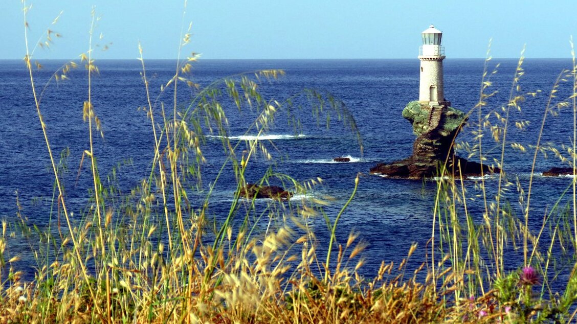
Tourlitis Lighthouse, first automatic lighthouse in Greece: The rock at the edge of Andros Town
At the northern end of Chora's peninsula, a small islet rises from the sea, and on top of it sits the Tourlitis Lighthouse — the only lighthouse in Greece built on a rock in the sea, and the first in the country to be automated. It has been guiding ships through this channel for more than 120 years. You cannot enter it, but you do not need to: the walk out along the headland to the point where it comes into full view is one of the better short walks in the Cyclades, particularly in the late afternoon when the light comes from the west. The lighthouse was destroyed during the Second World War and rebuilt in 1994. It is now a symbol of Andros to the degree that it appears on local signage and souvenirs throughout the island. The combination of the ruined Venetian castle immediately above you and the lighthouse on its rock below makes this headland one of the more layered viewpoints in the islands.
Insider tip
The path to the headland starts near the end of the main pedestrian street in Chora. It is unpaved and can be slippery after rain. Wear shoes with grip — the same sandals that work fine on the town's marble streets will betray you on wet rock.
The Corinth Canal connects the Gulf of Corinth with the Saronic Gulf, cutting through the Isthmus of Corinth and separating the Peloponnese from the Greek mainland. The canal was completed in 1893 after centuries of failed attempts and false starts — the Romans tried it, Nero reportedly broke ground on it, and the project was abandoned repeatedly before modern engineering made it viable. The drive from Athens on the E94 takes about 75 minutes in normal traffic, though the approach to the canal bridge can slow in summer. What you do on arrival is simple: park near the bridge, walk out onto it, and look straight down 79 metres into the channel below. The walls are vertical, the water is an improbable blue-green, and the scale of the cut — 6.3 kilometres long, barely 24 metres wide at water level — is more impressive in person than in any photograph. Small ships still transit it. Watch for one if you have time.
Insider tip
There is a bungee jumping operation at the bridge that runs on weekends. If you have no interest in it, arrive before 10am on a weekend or on any weekday morning — after 11am the bridge walkway fills with tour groups and the experience degrades significantly.
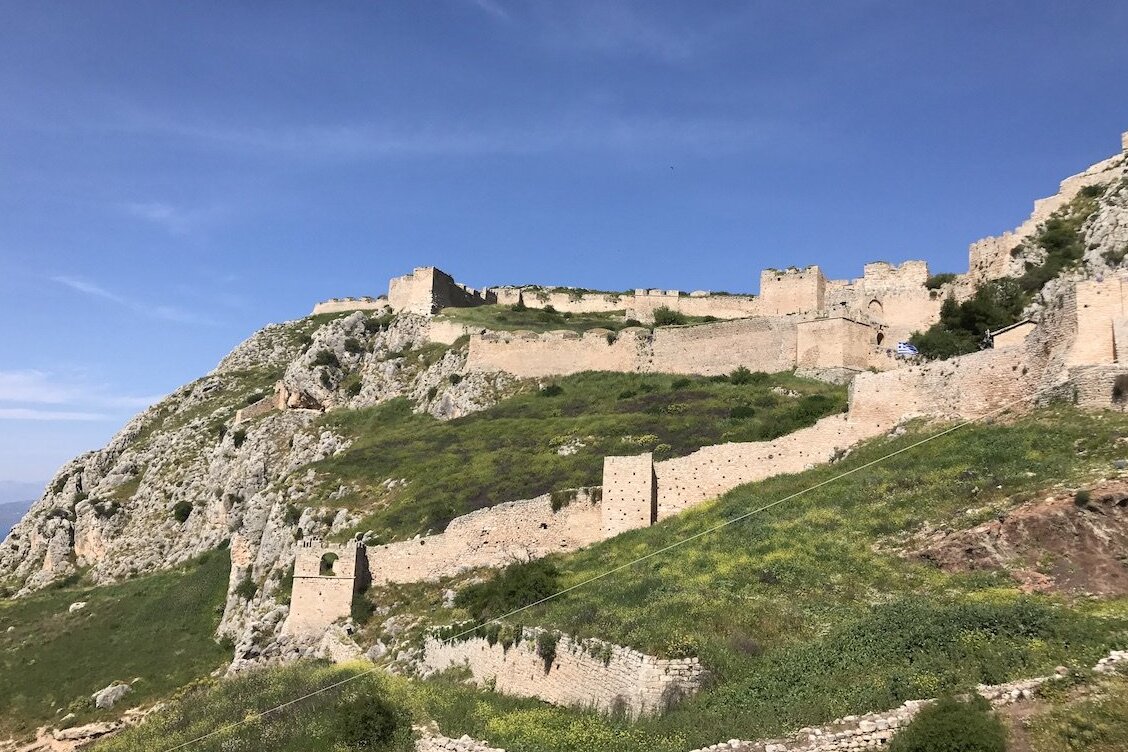
Acrocorinth is the acropolis of ancient Corinth, a massive natural rock rising to 575 metres above the plain, fortified continuously from antiquity through the Byzantine, Frankish, Venetian, and Ottoman periods. The result is one of the most complex and layered fortifications in Greece — three concentric lines of walls, towers from different centuries, and a summit that on a clear day gives you a view from the Saronic Gulf to the Gulf of Corinth. The drive from the Corinth Canal takes about 20 minutes, making this a natural pairing. The site is large and the climb from the car park to the inner gate is steep; allow at least 90 minutes once you are inside. The ruins are not manicured — this is raw, overgrown, genuinely ancient stonework — and that is precisely what makes it worth the effort. Few archaeological sites in Greece feel this abandoned and this honest at the same time.
Insider tip
Combine Acrocorinth with the Corinth Canal in a single day — they are 20 minutes apart by car. Start at the canal at 9am, drive to Acrocorinth by 10:30, and you will have the fortress largely to yourself before the midday heat arrives. Bring water; there is none sold inside.
7Archaeological site / Bridge· 81.9 km
The Arkadiko Bridge, also known as the Kazarma Bridge: The oldest bridge still in use
The Arkadiko Bridge, near Nafplio in the northeastern Peloponnese, is believed to be the oldest existing bridge in the world still used by local populations. It is a Mycenaean corbelled arch bridge, built during the Bronze Age — roughly 1300–1200 BCE — as part of a road system connecting Mycenae with Tiryns. The drive from Athens takes about 1 hour 45 minutes via the E65 and A7 motorways. The bridge itself is small — perhaps 22 metres long — and sits in a shallow valley off the main road, accessed by a short walk through scrubland. There are no ticket booths, no visitor centres, no crowds. You simply walk out onto a bridge that has been standing for over three thousand years and cross it, as local farmers still occasionally do. The understatement of the whole experience is the point. This is not a monument that has been packaged for consumption; it is just a very old bridge in a field.
Insider tip
The turn-off from the main Nafplio–Epidaurus road is easy to miss — look for a small brown archaeological sign. GPS coordinates are more reliable than road signs here. Combine with Nafplio town for lunch; the old town is 20 minutes away and has good waterfront options.
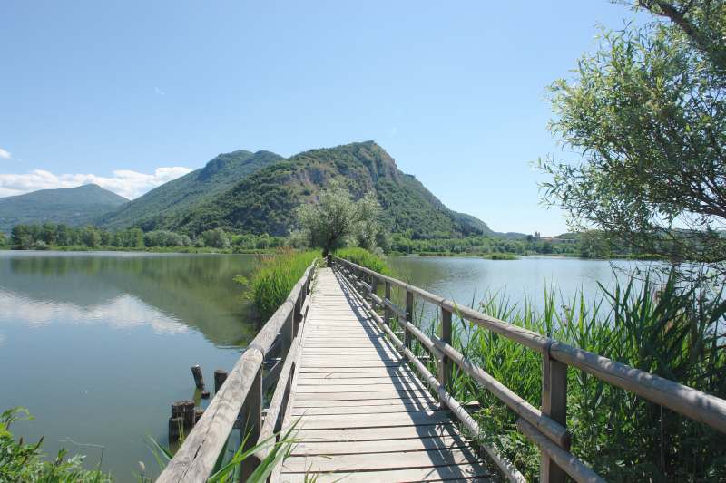
Korombili is a mountain ridge in central Greece, roughly 62 kilometres from Athens, set in a landscape of pine forest and open rock that feels entirely removed from the city. The source notes describe it as embodying tranquillity and unspoiled natural beauty — and on a weekday in spring or autumn, that description is accurate. This is not a destination for people who need a café on arrival; it is a destination for people who want to walk in the Greek countryside without driving four hours to do it. The approach by car takes about 75–90 minutes depending on your exact starting point in Athens and the condition of the mountain roads in the final section. The ridge itself offers clear-day views across the surrounding valleys. Bring your own provisions, wear appropriate footwear, and treat this as a half-day hiking excursion rather than a sightseeing stop.
Insider tip
Road conditions on the final approach to the ridge can deteriorate after winter, and a standard sedan may struggle on unpaved sections. A higher-clearance vehicle is advisable. Check weather forecasts the night before — mountain mist can close in quickly and eliminate the views that justify the trip.
9Religious / Byzantine monument· 97.2 km
Il Monastero di Ossios Loukas: The Byzantine mosaic complex in the Boeotian hills
The Monastery of Hosios Loukas stands in a fold of the hills above the Boeotian plain, about 97 kilometres northwest of Athens, and it is one of the most important surviving examples of middle Byzantine architecture and mosaic art in the world. It was founded in the 10th century by Saint Luke of Stiris, who died here in 953, and the main church contains an extraordinary programme of 11th-century mosaics — gold-ground compositions of Christ, the Virgin, and the saints — that are in a state of preservation that larger and more famous Byzantine sites rarely match. The drive from Athens takes about 1 hour 45 minutes via the E75 and the road through Distomo. The monastery is still active, which means dress codes apply (no bare shoulders or shorts) and there are hours when the church is closed for the monks' schedule. Plan your arrival between 8am and 1pm or after 4pm.
Insider tip
The village of Arachova, a further 20 kilometres up the road toward Delphi, makes an excellent lunch stop on the return journey. If you are driving this route on a winter weekend, be aware that Arachova is a ski-town overflow point for the Parnassus resort and traffic can be severe.
10Archaeological site / Coastal· 45.4 km
Temple of Poseidon in Sounion: The cliff-edge sanctuary at the edge of Attica
Cape Sounion sits at the southernmost tip of the Attica peninsula, 45 kilometres from central Athens, and the Temple of Poseidon that stands on its headland was built between 444 and 440 BCE — the same period that produced the Parthenon. Archaeological evidence suggests the site was sacred as far back as the Bronze Age. The temple is Doric, partially ruined, and positioned on a cliff above the sea at a height that makes it visible to ships approaching from the south — which was, of course, the point. Getting there: the KTEL bus from Pedion Areos square in Athens runs regularly and takes about 1 hour 30 minutes along the coastal road, passing a string of beach towns. The bus is the preferred option — parking at Sounion in summer is genuinely chaotic, and the coastal drive, while attractive, deposits you in a car park that fills by 10am on weekends. On arrival: walk the full perimeter of the temple, look for Lord Byron's name carved into one of the columns (he did it himself in 1810), and time your visit to catch the late afternoon light if possible.
Insider tip
The site faces west-southwest, which means late afternoon is dramatically better than midday for both light and temperature. The last KTEL bus back to Athens typically departs around 9pm in summer — confirm the schedule at the stop on arrival, as seasonal timetables change. Arriving by 5pm gives you golden-hour conditions and a manageable crowd.
Every city has a radius of escape, and Athens has one of the better ones. What strikes me, after years of running these routes in different seasons and by different means, is how quickly the city releases you. Forty-five minutes on a bus and you are standing on a cliff above the Aegean. Two hours on a fast ferry and you are on an island that most tourists have never heard of. An hour and a half in a car and you are crossing a Bronze Age bridge in an empty field. The logistics are never perfectly smooth — Greek transport infrastructure keeps you honest — but the imperfection is part of the texture of the thing. You learn to check ferry schedules the night before. You learn that parking near any ancient site in August is a negotiation with chaos. You learn that the best experiences tend to happen in the shoulder season, on a Tuesday, when the light is good and the site is yours. Plan carefully, leave early, and do not assume the last bus back will wait for you.
🏆 Pocket guide
Take this guide with you.
Save it offline, get walking directions, and discover thousands more places like the ones you just read.
What is the best time of year for day trips from Athens?
April–May and September–October are the most practical windows. Temperatures are manageable (20–28°C), ferry services are running full schedules, and the major archaeological sites are not at peak capacity. July and August work logistically but the heat between noon and 4pm is a genuine constraint — you will lose two to three hours of usable time at outdoor sites. November to March is excellent for driving routes like Hosios Loukas and Acrocorinth, but island ferry services reduce significantly, and some smaller sites keep abbreviated hours or close on Mondays.
Are Greek train passes worth buying for day trips from Athens?
For the destinations in this list, not particularly. The Greek rail network (Hellenic Train) is useful for routes toward Corinth and the northern Peloponnese, but several of these destinations — Sounion, Korombili, the Arkadiko Bridge — are not on rail lines at all, and the island destinations require ferries by definition. If you are planning multiple train journeys across Greece over a week or more, a Eurail pass that includes Greece can offer value, but for targeted day trips, individual tickets purchased at the station or online are simpler and often cheaper.
Is it practical to drive in Greece as a foreign visitor?
Yes, with caveats. Greek drivers are assertive and road signage outside major highways can be inconsistent — a GPS with offline maps (Google Maps downloaded for Greece, or Maps.me) is not optional, it is essential. The toll motorways (E65, E75, A7) are well-maintained and fast. Mountain roads to places like Korombili and Hosios Loukas are narrower and require more attention. Fuel stations are plentiful on main routes but sparse in rural areas — fill up before leaving the motorway. International driving licences are accepted; EU licences are valid without additional documentation.
How far in advance should I book ferries to Milos and Andros?
For Milos in July and August, book fast ferry seats at least five to seven days ahead — the high-speed vessels have limited capacity and popular morning departures sell out. For Andros from Rafina, the crossing is shorter and the ferry is larger, so three to four days ahead is usually sufficient in peak season. Outside July and August, booking the day before is generally fine. Use Ferryhopper or the individual ferry company websites (Seajets, Golden Star Ferries) for Andros from Rafina; Piraeus departures to Milos are served by multiple operators.
Can I do the Corinth Canal and Acrocorinth in the same day trip from Athens?
Yes, and this is one of the most efficient combinations in the list. Leave Athens by car before 8:30am to avoid motorway congestion on the A8/E94. Reach the Corinth Canal by 9:30–10am, spend 45 minutes there, then drive the 20 minutes to Acrocorinth. Allow 90 minutes to two hours at the fortress — it is larger than it looks from below. You will be back in Athens by 4–5pm, well before evening traffic builds. If you want to add ancient Corinth's archaeological site (the agora and Temple of Apollo, which are immediately below Acrocorinth), budget an additional hour and bring lunch, as the site café is basic.
🏆 Read this offline
Save it to your phone.
Bookmark this guide, plan your trip offline, and discover thousands of places like these.